


I have updated and corrected some of the data I posted summarizing Flight Data, which was erroneous. My bad! As many have noted— I am a crappy proofreader.
Fortunately, Arrigo de Angel at https://comedonchisciotte.org/ picked up on the discrepancies. Please visit his site— it’s very interesting!
As Arrigo points out, the all-important part in the article entitled, “The Evidence” doesn’t make sense when you read it carefully.
There are errors here that onk the Owl would have picked up. Below is the revised section, which I have also added to the article. The chart is new and I think clearer and easier to understand than the previous one.
The Evidence
Radar
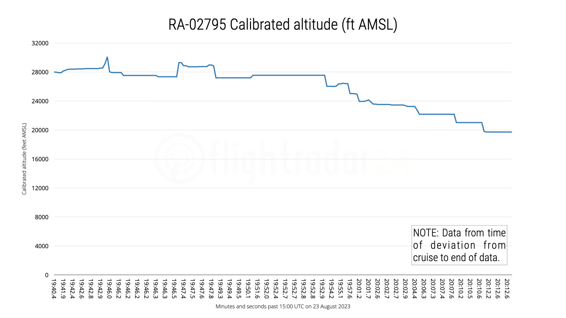
After leveling off at 28,000 feet at 15:10 UTC, the aircraft continued in level flight at consistent speed until 15:19 UTC at which point the vertical rate decreases dramatically and the aircraft descends briefly before climbing to a maximum altitude of 30,100 feet before descending back to roughly 27,500 feet. It again climbs, reaching 29,300 feet before leveling off once again. It then descends, with the final data received at 15:20:14 UTC at an altitude of 19,725 feet. The altitude graph below shows the final 32 seconds of received altitude data.
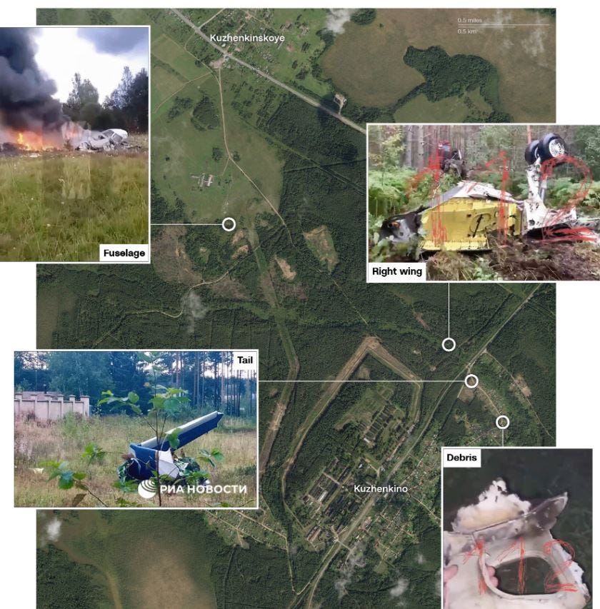
The location of the lost wing and tail indicate that it lost them; then dived to the ground. They were found some perhaps a kilometer or two from the site where the fuselage hit.
Honestly, I never heard of a moron who was concerned about the facts.
That graph is a nightmare to read. I didn't even go for trying the first part. The data drops on this event were so choppy and nonsequential that it created about 15 various potential narratives. Picking only one is nearly impossible (by design it seems). That graph really should have been cleaned up before release. It's almost like it was meant to be deceptive. Like so much about this story.